
The power of Geospatial Information Systems as a tool to analyse data on impact of adaptation
21st September 2022, Nukualofa, Tonga – A first in meeting mutual needs in the Kingdom of Tonga took place this week at a time when the nation is celebrating National Climate Change Awareness
Week.
A team of two staff members from the Lands Geospatial Information Systems (LGIS) division under the Ministry of Lands & Natural Resources responded to an urgent call to accurately geolocate coastal protection structures on Tongatapu.
The call was made through the Ministry of Meteorology, Energy, Information, Disaster Management, Environment, Climate Change and Communications (MEIDECC) for the GCCA+ Scaling up Pacific Adaptation (SUPA) project. Geolocation refers to identifying the geographical location of a person or device by means of digital information processed via the internet.
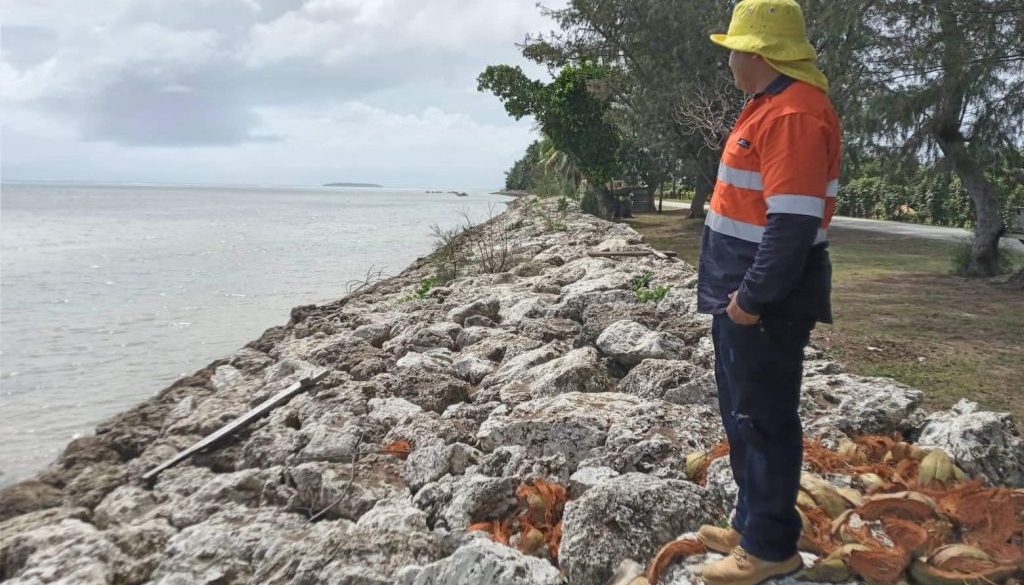
The survey began at the eastern coast from Kolonga with the use of a Global Positioning System (GPS-GNSS) to determine the form, boundary, and position of groynes, detached breakwaters, rock revetments and barriers built to protect the coastline and coastal communities of Tongatapu.
As the Chief Geospatial Information Officer, Makameone Fifita shared: “The geospatial technology is always advancing. It is three-dimensional and helps to visualise what is on the ground. You give us data and we can analyse the same data to visualise impact, for example, this exercise of geolocating the protection measures. It will be good that others utilise LGIS in project planning and engage from the start when setting targets for activities, makes it easier for us to update information and interpret data collected to understand the results of project activities”.
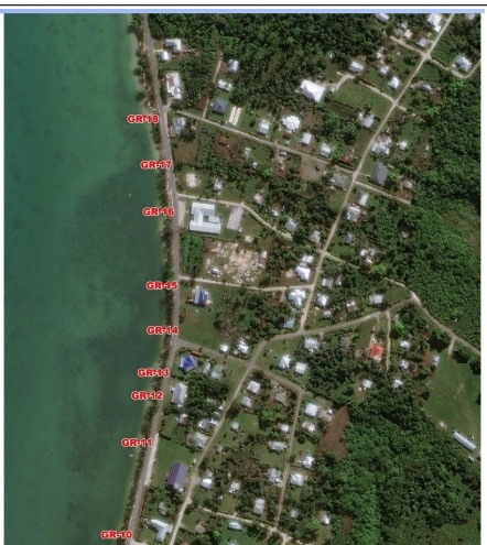
Figure 1. Display of groynes along the coastline of Makaunga in Eastern Tongatapu
A previous study in 2021 from analysing the efficiency of the structural coastal protection structures in the selected coastal communities, suggest medium positive impact on the communities.
Results from the social and behavioural change analysis showed that most participants considered that the infrastructure had helped protect the coastline, however there was a desire for further strengthening.

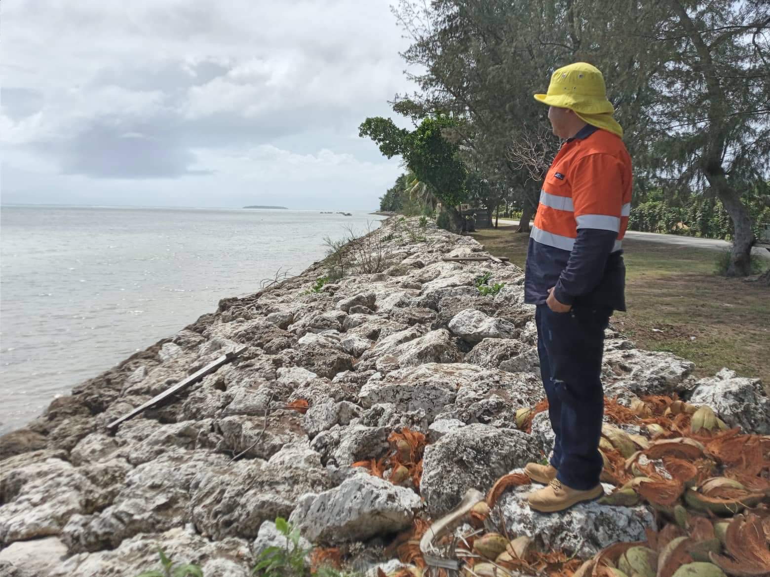
Figure 2. Staff members from the Lands Geospatial Information Systems (LGIS) geolocating the rock revetment in Kolonga
With a growth mindset, MEIDECC since organising the first national climate change awareness in 2019 urged the nation to “Increase climate action to save Tonga”.
The theme of this week is “Building a Resilient Tonga” calling upon all stakeholders, from families to businesses, youth and schools for mutual cooperation in building resiliency.
Link: https://ee.humanitarianresponse.info/x/XXNmKq9s
The GCCA+ SUPA project, funded by the European Union is delivered collaboratively by SPREP, Pacific Community (SPC) and the University of the South Pacific (USP) with the aim to enhance climate change adaptation and resilience within the Pacific region.